File:Niuatoputapu group.jpg
Size of this preview: 800 × 531 pixels. Other resolutions: 320 × 212 pixels | 640 × 425 pixels | 1,024 × 680 pixels | 1,280 × 850 pixels | 3,060 × 2,032 pixels.
ʻAsi ʻa e faitā auiiki ((3,060 × 2,032 meʻaʻata, ko e faile hono lahi: 1.06 MB, faʻahinga MIME: image/jpeg))
Fakanounou
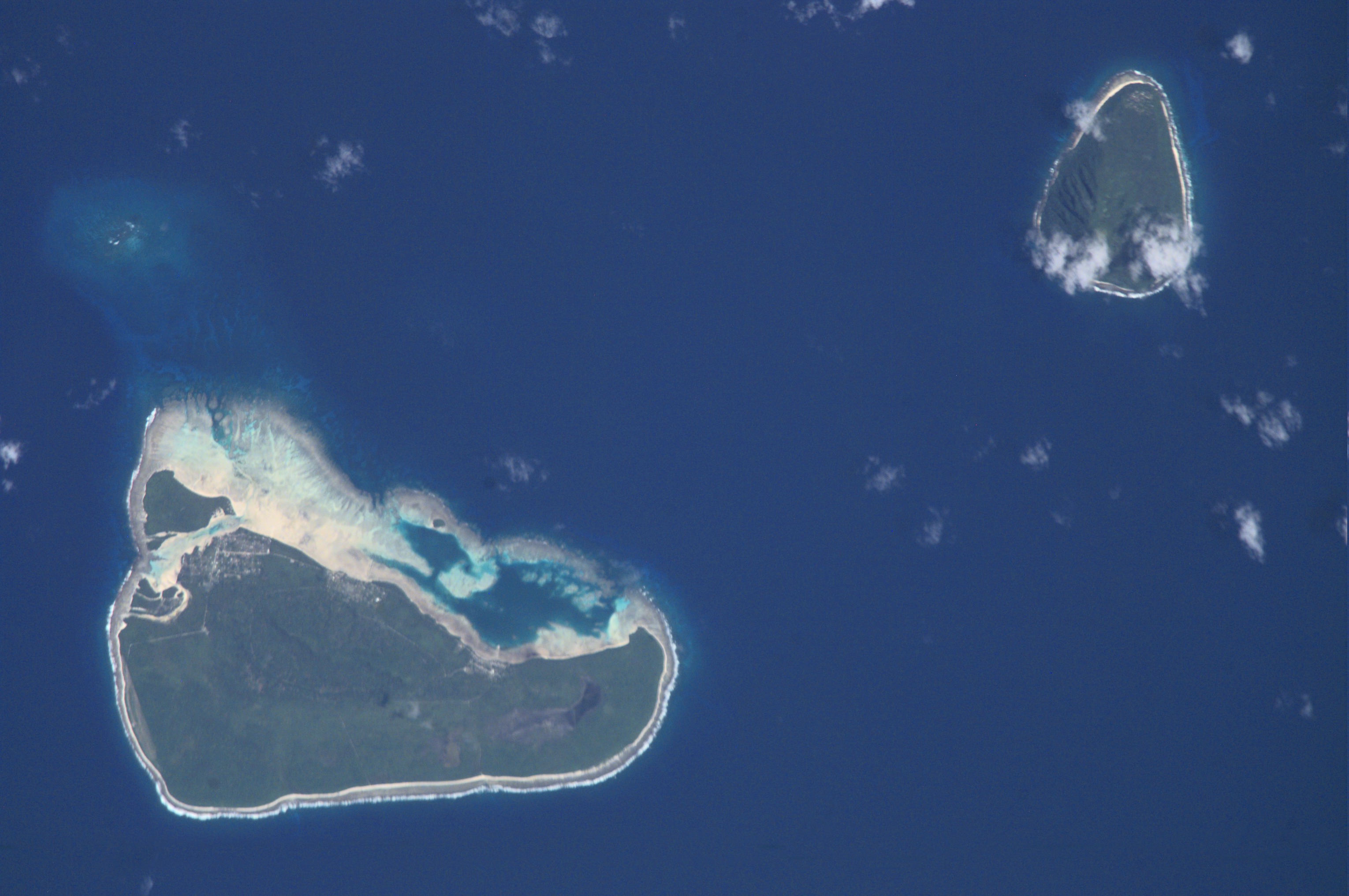
| Fakamahino | Niuatoputapu (south) and Tafahi (north) islands, Niuas Group, Tonga, from space. | ||
| Date | |||
| Tupunga | http://eol.jsc.nasa.gov/scripts/sseop/photo.pl?mission=ISS002&roll=E&frame=6435 rotated with north on top, cropped, edited and colour corrected. | ||
| Author |
|
||
| Other versions |
Laiseni:
| This file is in the public domain in the United States because it was solely created by NASA. NASA copyright policy states that "NASA material is not protected by copyright unless noted". (See Template:PD-USGov, NASA copyright policy page or JPL Image Use Policy.) | ||
 |
Warnings:
|
Hisitōlia ʻo e faile
Lomiʻi ha ʻaho/taimi ki he vakai ʻo e faile naʻe ʻi ai he taimi ko iá.
| ʻAho/Taimi | ʻAtasiʻi | Hono lahi | ʻEtita | Fakamatala | |
|---|---|---|---|---|---|
| taka | 20:16, 19 ʻAokosi 2018 | | 3,060 × 2,032 (1.06 MB) | Skimel | Cropped rotated 180° using CropTool with lossless mode. |
| 19:48, 19 ʻAokosi 2018 |  | 3,060 × 2,032 (1.06 MB) | Skimel | Cropped 3 % vertically using CropTool with lossless mode. | |
| 19:28, 19 ʻAokosi 2018 |  | 3,060 × 2,092 (1.04 MB) | Skimel | New image from the Nasa website, better resolution | |
| 09:55, 4 Fēpueli 2007 |  | 518 × 742 (26 KB) | Tauʻolunga | ||
| 16:30, 14 Nōvema 2006 |  | 292 × 412 (12 KB) | Vriullop | {{Information |Description=Niuatoputapu (south) and Tafahi (north) islands, Niuas Group, Tonga, from space. |Source=http://eol.jsc.nasa.gov/sseop/images/ESC/small/ISS004/ISS004-E-5924.JPG rotated with north on top and cropped. |Date=13-1-2002 |Author={{As |
Faitā fehokotaki
ʻOku fehokotaki ʻa e ngaahi peesi ki he failé ni:
Global file usage
The following other wikis use this file:
- Usage on ceb.wikipedia.org
- Usage on de.wikipedia.org
- Usage on es.wikipedia.org
- Usage on fi.wikipedia.org
- Usage on fr.wikipedia.org
- Niuatoputapu
- Tafahi
- Discussion:Niuas
- Niuatoputapu (langue)
- Utilisateur:Skimel/illustration des îles du Pacifique
- Wikipédia:Statistiques des anecdotes de la page d'accueil/Visibilité des anecdotes (2022)
- Discussion:Niuas/LSV 21666
- Wikipédia:Statistiques des anecdotes de la page d'accueil/Visibilité des anecdotes (2022)/2022 12
- Projet:Aide et accueil/Twitter/Tweets/archives/décembre 2022
- Wikipédia:Le saviez-vous ?/Archives/2022
- Usage on gl.wikipedia.org
- Usage on ka.wikipedia.org
- Usage on ru.wikipedia.org
- Usage on sv.wikipedia.org