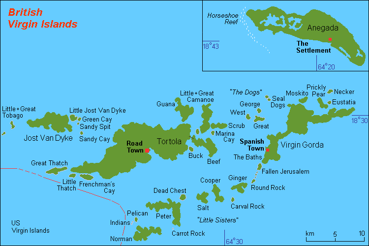
File:GB Virgin Islands.png
GB_Virgin_Islands.png ((750 × 500 meʻaʻata, ko e faile hono lahi: 11 KB, faʻahinga MIME: image/png))
Hisitōlia ʻo e faile
Lomiʻi ha ʻaho/taimi ki he vakai ʻo e faile naʻe ʻi ai he taimi ko iá.
| ʻAho/Taimi | ʻAtasiʻi | Hono lahi | ʻEtita | Fakamatala | |
|---|---|---|---|---|---|
| taka | 22:51, 28 Maʻasi 2020 |  | 750 × 500 (11 KB) | Agricolae | add long because there is also an E-W offset to the inset |
| 01:39, 23 Maʻasi 2020 |  | 750 × 500 (24 KB) | Agricolae | add line and lat to better illustrate that Anegada is not contiguous with rest of map | |
| 08:43, 24 ʻAokosi 2008 |  | 750 × 500 (18 KB) | Hobe | {{Information |Description=corrected version map GB Virgin Islands (rough) |Source=own work, composed from various mapreferences |Date=20-08-2008 |Author=HoBe |Permission= |other_versions= Category:Maps of the British Virgin Islands }} | |
| 20:26, 13 Sānuali 2008 |  | 750 × 500 (18 KB) | Hobe | Description: map GB Virgin Islands (rough) Source: own work, composed from various mapreferences, correct version Date: 2008-01-04 Author: Holger Behr Category:Maps of the British Virgin Islands | |
| 08:44, 10 Sānuali 2008 |  | 700 × 500 (17 KB) | Hobe | {{Information |Description=map GB Virgin Islands (rough) |Source=own work, composed from various mapreferences |Date=2008-01-04 |Author=Holger Behr |Permission= |other_versions= }} Category:Maps of the British Virgin Islands |
Faitā fehokotaki
ʻOku fehokotaki ʻa e ngaahi peesi ki he failé ni:
Global file usage
The following other wikis use this file:
- Usage on als.wikipedia.org
- Usage on ar.wikipedia.org
- Usage on bn.wikipedia.org
- Usage on br.wikipedia.org
- Usage on ceb.wikipedia.org
- Usage on cs.wikipedia.org
- Usage on da.wikipedia.org
- Usage on de.wikipedia.org
- Usage on de.wikivoyage.org
- Usage on en.wikipedia.org
- Usage on es.wikipedia.org
- Usage on gl.wikipedia.org
View more global usage of this file.

