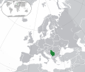
File:Map of Europe and Serbia (2006–2008).svg

Size of this PNG preview of this SVG file: 713 × 600 pixels. Other resolutions: 285 × 240 pixels | 571 × 480 pixels | 913 × 768 pixels | 1,218 × 1,024 pixels | 2,435 × 2,048 pixels | 2,045 × 1,720 pixels.
ʻAsi ʻa e faitā auiiki ((Faile SVG, lau pē 2,045 × 1,720 meʻaʻata, ko e faile hono lahi: 7.39 MB))
Hisitōlia ʻo e faile
Lomiʻi ha ʻaho/taimi ki he vakai ʻo e faile naʻe ʻi ai he taimi ko iá.
| ʻAho/Taimi | ʻAtasiʻi | Hono lahi | ʻEtita | Fakamatala | |
|---|---|---|---|---|---|
| taka | 08:17, 27 Fēpueli 2022 |  | 2,045 × 1,720 (7.39 MB) | Ahmet Q. | Reverted to version as of 06:52, 24 February 2022 (UTC)rv again |
| 13:54, 26 Fēpueli 2022 |  | 2,045 × 1,720 (7.34 MB) | TómasdeAquino2 | Rv pov-pushing | |
| 06:52, 24 Fēpueli 2022 |  | 2,045 × 1,720 (7.39 MB) | Ahmet Q. | Reverted to version as of 12:02, 16 October 2021 (UTC)Rv-POV pushing | |
| 20:08, 14 Sānuali 2022 |  | 2,045 × 1,720 (7.34 MB) | TómasdeAquino2 | npov | |
| 12:02, 16 ʻOkatopa 2021 |  | 2,045 × 1,720 (7.39 MB) | InNeed95 | Reverted to version as of 19:40, 16 January 2018 (UTC) Tells about the dispute between serbia and Kosovo. / Should be shown. | |
| 01:28, 13 ʻOkatopa 2021 |  | 2,045 × 1,720 (7.48 MB) | AmeSavoia | Reverted to version as of 14:30, 15 January 2018 (UTC) | |
| 19:40, 16 Sānuali 2018 |  | 2,045 × 1,720 (7.39 MB) | Jedi Friend | Reverted to version as of 18:42, 27 December 2017 (UTC) Did you even read what I said? | |
| 14:30, 15 Sānuali 2018 |  | 2,045 × 1,720 (7.48 MB) | Partizan45 | Reverted to version as of 11:10, 16 December 2017 (UTC) | |
| 18:42, 27 Tisema 2017 |  | 2,045 × 1,720 (7.39 MB) | Jedi Friend | Reverted to version as of 18:15, 13 December 2017 (UTC) Serbia does not have de facto control over Kosovo. As such, Kosovo should be coloured differently so as to make it clear it's a disputed territory. | |
| 11:10, 16 Tisema 2017 |  | 2,045 × 1,720 (7.48 MB) | Partizan45 | Reverted to version as of 12:59, 24 August 2017 (UTC) |
Faitā fehokotaki
ʻOku fehokotaki ʻa e ngaahi peesi ki he failé ni:
Global file usage
The following other wikis use this file:
- Usage on ady.wikipedia.org
- Usage on af.wikipedia.org
- Usage on ar.wikipedia.org
- Usage on arz.wikipedia.org
- Usage on avk.wikipedia.org
- Usage on ay.wikipedia.org
- Usage on az.wikipedia.org
- Usage on az.wiktionary.org
- Usage on ba.wikipedia.org
- Usage on bbc.wikipedia.org
- Usage on bcl.wikipedia.org
- Usage on be.wikipedia.org
- Usage on bh.wikipedia.org
- Usage on bi.wikipedia.org
- Usage on bn.wikipedia.org
- Usage on br.wikipedia.org
- Usage on bxr.wikipedia.org
- Usage on ca.wikipedia.org
- Usage on cdo.wikipedia.org
- Usage on chy.wikipedia.org
- Usage on crh.wikipedia.org
- Usage on cs.wikipedia.org
- Usage on de.wikipedia.org
- Usage on dsb.wikipedia.org
- Usage on en.wikipedia.org
- Usage on es.wikipedia.org
- Usage on eu.wikipedia.org
- Usage on fa.wikipedia.org
- Usage on fi.wiktionary.org
- Usage on fr.wikipedia.org
- Usage on gcr.wikipedia.org
- Usage on gu.wikipedia.org
- Usage on hak.wikipedia.org
- Usage on he.wikipedia.org
- Usage on hi.wikipedia.org
- Usage on hu.wikipedia.org
- Usage on ia.wikipedia.org
- Usage on id.wikipedia.org
View more global usage of this file.