File:Estonia municipalities.png

Size of this preview: 800 × 513 pixels. Other resolutions: 320 × 205 pixels | 640 × 411 pixels | 1,024 × 657 pixels | 1,280 × 821 pixels | 1,601 × 1,027 pixels.
ʻAsi ʻa e faitā auiiki ((1,601 × 1,027 meʻaʻata, ko e faile hono lahi: 82 KB, faʻahinga MIME: image/png))
Fakanounou
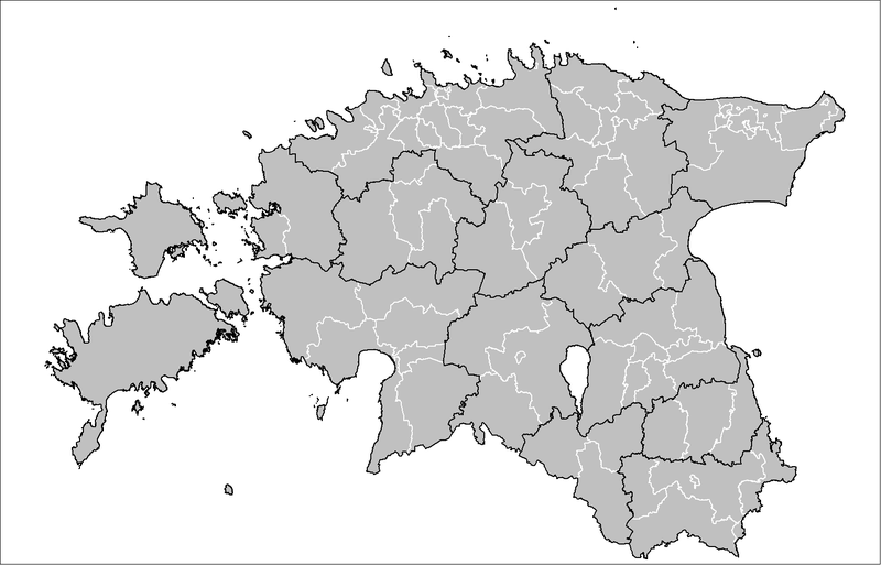
| Fakamahino | Map of the municipalities of Estonia after the 2017 municipal reform. Created by Rarelibra 15:43, 20 December 2006 (UTC) for public domain use, using MapInfo Professional v8.5 and various mapping resources. |
| Date | 20 Tisema 2006 (original upload date) |
| Tupunga | No machine-readable source provided. Own work assumed (based on copyright claims). |
| Author | No machine-readable author provided. Rarelibra assumed (based on copyright claims). |

|
This image could be re-created using vector graphics as an SVG file. This has several advantages; see Commons:Media for cleanup for more information. If an SVG form of this image is available, please upload it and afterwards replace this template with
{{vector version available|new image name}}.
It is recommended to name the SVG file “Estonia municipalities.svg”—then the template Vector version available (or Vva) does not need the new image name parameter. |
Laiseni:
| I, the copyright holder of this work, release this work into the public domain. This applies worldwide. In some countries this may not be legally possible; if so: I grant anyone the right to use this work for any purpose, without any conditions, unless such conditions are required by law. |
Hisitōlia ʻo e faile
Lomiʻi ha ʻaho/taimi ki he vakai ʻo e faile naʻe ʻi ai he taimi ko iá.
| ʻAho/Taimi | ʻAtasiʻi | Hono lahi | ʻEtita | Fakamatala | |
|---|---|---|---|---|---|
| taka | 19:50, 8 ʻEpeleli 2019 | | 1,601 × 1,027 (82 KB) | H2ppyme | Fixed Kohila Parish |
| 14:51, 8 Tisema 2017 |  | 1,601 × 1,027 (72 KB) | RoMex | Updated according to the 2017 municipal reform. | |
| 07:33, 10 Maʻasi 2017 |  | 1,601 × 1,027 (102 KB) | H2ppyme | Corrected borders of Põlva and Rakvere parishes and Võhma Town. | |
| 01:44, 4 Sānuali 2015 |  | 1,601 × 1,027 (122 KB) | Flying Saucer | updated Lääne-Saare Parish | |
| 23:35, 25 ʻOkatopa 2013 |  | 1,601 × 1,027 (122 KB) | Flying Saucer | October 2013 updates | |
| 12:30, 2 Sēpitema 2010 |  | 1,601 × 1,027 (110 KB) | H2ppyme | Kaisma Parish merged with Vändra Parish | |
| 13:40, 24 Maʻasi 2008 |  | 1,601 × 1,027 (76 KB) | Rarelibra | updated map style | |
| 17:39, 8 Sānuali 2007 |  | 1,281 × 878 (56 KB) | Rarelibra | Updated map of the municipalities of Estonia (due to 2006 updates). | |
| 15:43, 20 Tisema 2006 |  | 1,281 × 878 (41 KB) | Rarelibra | Map of the municipalities of Estonia. Created by ~~~~ for public domain use, using MapInfo Professional v8.5 and various mapping resources. |
Faitā fehokotaki
ʻOku fehokotaki ʻa e ngaahi peesi ki he failé ni:
Global file usage
The following other wikis use this file:
- Usage on ar.wikipedia.org
- Usage on arz.wikipedia.org
- Usage on ba.wikipedia.org
- Usage on bn.wikipedia.org
- Usage on bs.wikipedia.org
- Usage on ca.wikipedia.org
- Usage on ceb.wikipedia.org
- Usage on cs.wikipedia.org
- Usage on da.wikipedia.org
- Usage on de.wikipedia.org
- Usage on el.wikipedia.org
- Usage on en.wikipedia.org
- Usage on et.wikipedia.org
- Eesti
- Eesti külade loend
- Arutelu:Eesti
- Eesti haldusüksuste lippude loend
- Eesti haldusjaotus
- URBACT
- Eesti regionaalpoliitika
- Eesti omavalitsuste haldusreform
- Eesti haldusüksuste vappide loend
- Vikipeedia arutelu:Vikiprojekt KOV 2017
- Kasutaja:Telempe/Mall:KOV2017
- Mall:Eesti maakondade lippude kaart
- Mall:Eesti maakondade vappide kaart
- Usage on fa.wikipedia.org
- Usage on fiu-vro.wikipedia.org
- Usage on fi.wikipedia.org
- Usage on fr.wikipedia.org
- Usage on hu.wikipedia.org
- Usage on it.wikipedia.org
- Usage on ja.wikipedia.org
- Usage on ka.wikipedia.org
- Usage on la.wikipedia.org
- Usage on mk.wikipedia.org
- Usage on my.wikipedia.org
- Usage on nl.wikipedia.org
- Usage on nn.wikipedia.org
- Usage on no.wikipedia.org
View more global usage of this file.