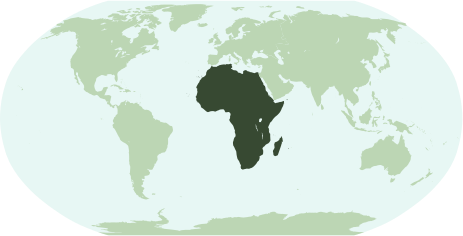
File:AfricaLocation.svg

Size of this PNG preview of this SVG file: 463 × 236 pixels. Other resolutions: 320 × 163 pixels | 640 × 326 pixels | 1,024 × 522 pixels | 1,280 × 652 pixels | 2,560 × 1,305 pixels.
ʻAsi ʻa e faitā auiiki ((Faile SVG, lau pē 463 × 236 meʻaʻata, ko e faile hono lahi: 290 KB))
Hisitōlia ʻo e faile
Lomiʻi ha ʻaho/taimi ki he vakai ʻo e faile naʻe ʻi ai he taimi ko iá.
| ʻAho/Taimi | ʻAtasiʻi | Hono lahi | ʻEtita | Fakamatala | |
|---|---|---|---|---|---|
| taka | 01:23, 15 Sānuali 2007 |  | 463 × 236 (290 KB) | Notscott | {{en|Map showing the location of the continent of Africa (including indian ocean islands near Madagascar).}} {{fr|Une carte pour démontrer la location du continent de l'Afrique (avec des îles d'océan indien près de Madagasque).}} {{ia|Un Mapa monstran |
| 23:50, 14 Sānuali 2007 |  | 463 × 236 (290 KB) | Notscott | {{en|Map showing the location of the continent of Africa (including indian ocean islands near Madagascar).}} {{fr|Une carte pour démontrer la location du continent d'Afrique (avec des îles d'océan indien près de Madagasque).}} {{ia|Un Mapa monstrante |
Faitā fehokotaki
ʻOku fehokotaki ʻa e ngaahi peesi ki he failé ni:
Global file usage
The following other wikis use this file:
- Usage on arz.wikipedia.org
- جنوب السودان
- ليبيا
- مصر
- جمهورية كونجو الديموقراطيه
- زيمبابوى
- اسواتينى
- سينيجال
- رواندا
- اوجاندا
- ثيويتا
- الجزاير
- سانت هيلينا
- قالب:افريقيا
- قالب:امريكا الجنوبية/شرح
- قالب:شرح استعمال قوالب القارات
- اريتريا
- شمال افريقيا
- شرق افريقيا
- وسط افريقيا
- كوت ديفوار
- جيبوتى
- بوركينا فاسو
- بوتسوانا
- افريقيا الوسطى
- الاحزاب السياسية فى تونس
- الاحزاب السياسية فى جنوب السودان
- الاحزاب السياسية فى السودان
- الاحزاب السياسيه فى المغرب
- جمهورية الكونجو
- جينيا
- جامبيا
- لغات مصر
- قالب:الاحزاب السياسيه فى دول افريقيا
- قالب:اناشيد دول افريقيا الوطنيه
- قالب:جامعات افريقيا
- Usage on avk.wikipedia.org
- Usage on bi.wikipedia.org
- Usage on bm.wikipedia.org
- Usage on bpy.wikipedia.org
- Usage on cbk-zam.wikipedia.org
- Usage on ch.wikipedia.org
- Usage on en.wikipedia.org
View more global usage of this file.