File:New South Wales regions map.png
Size of this preview: 689 × 600 pixels. Other resolutions: 276 × 240 pixels | 551 × 480 pixels | 882 × 768 pixels | 1,176 × 1,024 pixels | 1,592 × 1,386 pixels.
ʻAsi ʻa e faitā auiiki ((1,592 × 1,386 meʻaʻata, ko e faile hono lahi: 1.26 MB, faʻahinga MIME: image/png))
Fakanounou
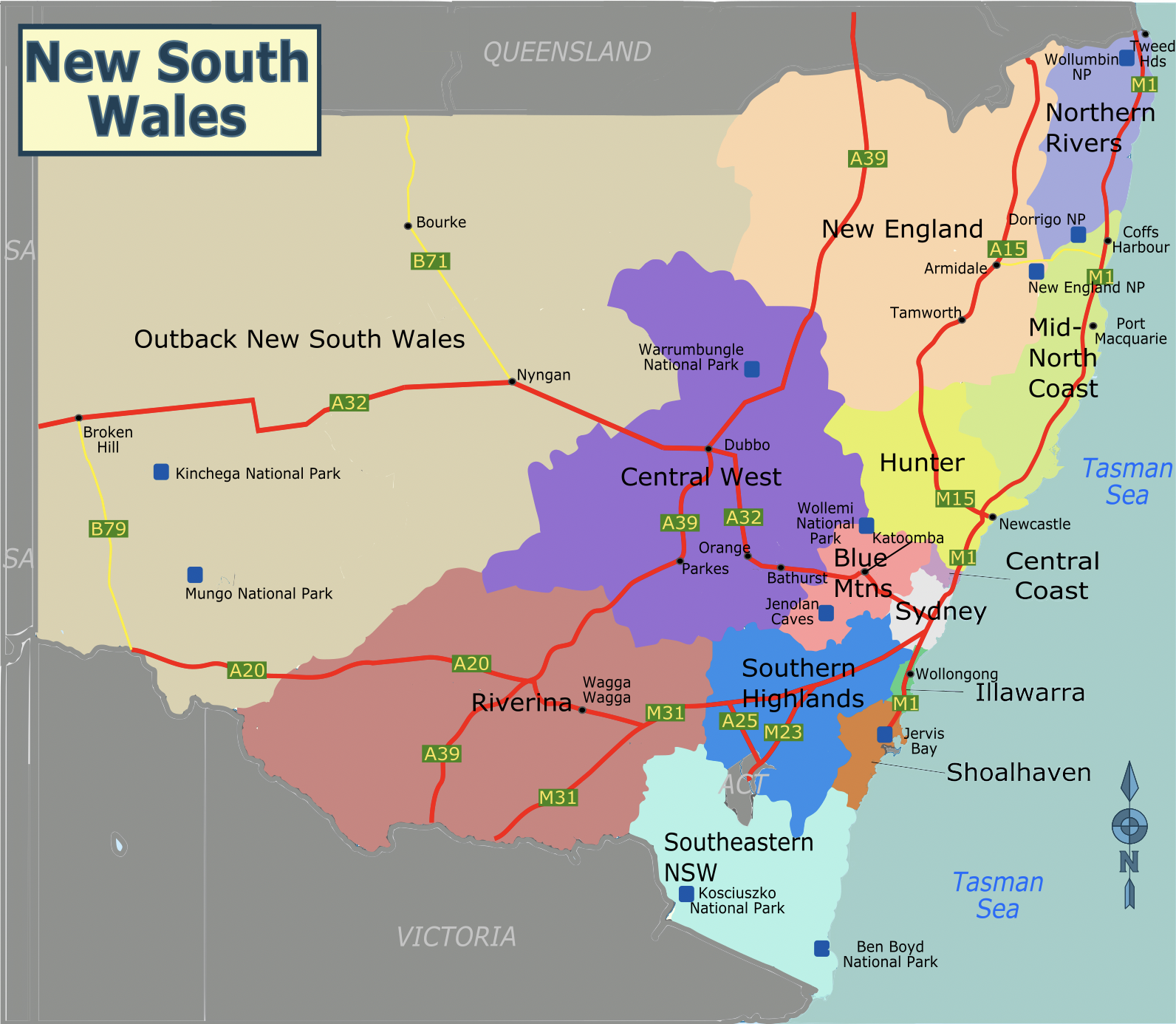
| Fakamahino | A static map of the regions of New South Wales, for use on voy:en:New South Wales. |
| Date | |
| Tupunga | Own work based on File:Australia New South Wales location map.svg |
| Author | SHB2000 |
| Other versions | SVG version |
Laiseni:
This file is licensed under the Creative Commons Attribution-Share Alike 3.0 Unported license.
- You are free:
- to share – to copy, distribute and transmit the work
- to remix – to adapt the work
- Under the following conditions:
- attribution – You must give appropriate credit, provide a link to the license, and indicate if changes were made. You may do so in any reasonable manner, but not in any way that suggests the licensor endorses you or your use.
- share alike – If you remix, transform, or build upon the material, you must distribute your contributions under the same or compatible license as the original.
Hisitōlia ʻo e faile
Lomiʻi ha ʻaho/taimi ki he vakai ʻo e faile naʻe ʻi ai he taimi ko iá.
| ʻAho/Taimi | ʻAtasiʻi | Hono lahi | ʻEtita | Fakamatala | |
|---|---|---|---|---|---|
| taka | 11:49, 28 Sune 2022 | | 1,592 × 1,386 (1.26 MB) | SHB2000 | Update PNG file |
| 12:23, 24 Sune 2022 |  | 1,398 × 1,208 (1,022 KB) | SHB2000 | update png file | |
| 07:58, 24 Sune 2022 |  | 744 × 1,052 (87 KB) | SHB2000 | {{Information |Description=A static map of the regions of New South Wales, for use on voy:en:New South Wales. |Source={{own}} based on File:Australia New South Wales location map.svg |Date=2022-06-24 |Author=SHB2000 |Permission= |other_versions=SVG version }} |
Faitā fehokotaki
ʻOku fehokotaki ʻa e ngaahi peesi ki he failé ni:
Global file usage
The following other wikis use this file:
- Usage on en.wikivoyage.org
- Usage on fr.wikivoyage.org
- Usage on ru.wikipedia.org
- Usage on ru.wikivoyage.org